About Tom Harrison: Mammoth High Country
Tom Harrison Maps has produced high-quality California hiking trail maps for a number of years now. To reach a new wave of technologically savvy outdoor enthusiasts, Tom Harrison Maps teamed up with International Mapping...
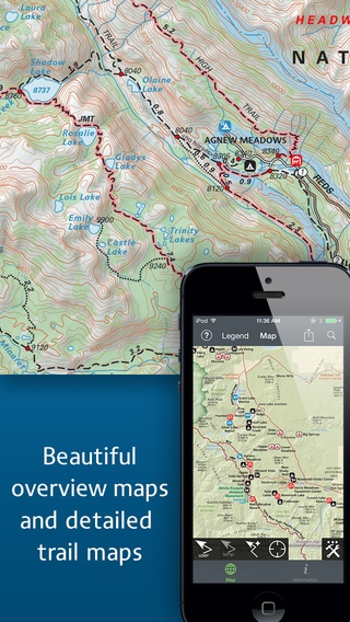
Tom Harrison Maps has produced high-quality California hiking trail maps for a number of years now. To reach a new wave of technologically savvy outdoor enthusiasts, Tom Harrison Maps teamed up with International Mapping to adapt their trail map series for the iPhone and iPad. International Mapping has surrounded their maps with a variety of easy-to-use navigational tools and personal customization features to help make your outdoor experience more enjoyable and memorable. California s Mammoth High Country is one of the most popular getaway and outdoor recreation areas in the United States. Planning a hike in the Mammoth High Country? Looking for an app to help you navigate all of the trails? Worried you will not have Wi-Fi access while out on the trail? Then this is the app for you as we have included everything you will need in the download! Key Content Features: + Full content and detail from Tom Harrison s Mammoth High Country map covering Minarets, June Lake, Ritter Range, Convict Lake, Mono Craters, Devils Postpiles, Mammoth Lakes, Agnew Meadows, and Thousand Island Lake. + Point of Interest listings for over 500 locations in and around the Mammoth High Country Area Key Features Include: + GPS tracking of your location, even without Wi-Fi or cell reception + A revolutionary new trail navigation system + Detailed, offline terrain profiling and statistics for any trail you create + Map tools including distance, bearing and compass + Customized pins to record photos, comments, & Locations along your hike + Share your custom markers with others who have the app + Customize your markers to change their appearance + Detailed search capabilities by nearby locations and by type + Identify the Latitude/Longitude for any place on the map Tom Harrison: Mammoth High Country was developed by International Mapping. To learn more visit: www.internationalmapping.com
Requires iOS 8.3 or later. Compatible with iPhone, iPad, and iPod touch.
Previous Versions
Here you can find the changelog of Tom Harrison: Mammoth High Country since it was posted on our website on 2016-10-01 11:38:39.
The latest version is 3.0.0 and it was updated on 2024-04-22 21:09:02. See below the changes in each version.
Tom Harrison: Mammoth High Country version 3.0.0
Updated At: 2012-03-30
Disclaimer
Official App Store Link
We do not host Tom Harrison: Mammoth High Country on our servers. We did not scan it for viruses, adware, spyware or other type of malware. This app is hosted by Apple and passed their terms and conditions to be listed there. We recommend caution when installing it.
The App Store link for Tom Harrison: Mammoth High Country is provided to you by apps112.com without any warranties, representations or guarantees of any kind, so access it at your own risk.
If you have questions regarding this particular app contact the publisher directly. For questions about the functionalities of apps112.com contact us.